
SCANLARK

Kurs/Position
vor 2 Min
Die letzten Häfen
Die letzten Wegpunkte
Die neuesten Nachrichten
State Security Department not only investigating crimes but also working on potential threat prevention
According to the Flensburg Public Prosecutor's Office, the investigating authorities were currently working intensively on the 'Scanlark' case. The State Security Department of the State Criminal Police Office was not only investigating which crimes may have already been committed, but officers were also working on potential threat prevention, which means that the State Security Department of the State Criminal Police Office was not only investigating whether a drone was actually launched from the freighter. Officers were also monitoring the ship to ensure that something similar cannot happen again. It was still unclear when the ship will be able to continue its voyage. Rhe State Criminal Police Office announced that: an "investigation has been initiated on suspicion of spying for the purposes of sabotage. Furthermore, the investigation concerns images of military installations that pose a security risk – such as photos – as well as preventing threats to Germany's critical maritime infrastructure." Due to the complexity of this case, no further information on the investigation was provided, according to the public prosecutor's office. The case was also expected to be discussed in the Interior and Legal Affairs Committee of the Schleswig-Holstein State Parliament in Octobe. The "Scanlark" arrived in Kiel from the North Sea. It had already come to the attention of the authorities months ago. Among other things, the ship was said to have deviated from its planned course. Furthermore, the freighter had been under the authorities' scrutiny for years: The recent case also has a Dutch component because the 'Scanlark' was in Rotterdam in the days before the police operation in Kiel. Between Sep 2 and 5, the ship was moored in the Waalhaven and Botlek harbors. It is unknown what the ship was doing there, but the Port Authority observed no suspicious movements during those three days. The 'Scanlark' remained stationary in Kiel as of Sep 12.
Russian spy freighter no longer seaworthy
While the crew of the "Scanlark" received a visit from the Seamen's Mission on board, the ship has not been confiscated, and the crew has not been arrested. But after the robust police operation. the suspected spy freighter is no longer seaworthy. Security-relevant doors were reportedly broken open, which can now no longer be closed and equipment necessary for the safe navigation of the ship has been confiscated. The German Employers' Liability Insurance Association (BG Verkehr) would have to release the "Scanlark" to continue its voyage from Kiel after a port state inspection, which has not yet taken place. At the moment, the ship is not seaworthy, and an inspection cannot be foreseen in the near future. As long as the appropriate equipment is not on board, an inspection makes no sense. This means that replacement equipment would probably be needed, as the original equipment has been confiscated as evidence for an initially indefinite period. The total amount of evidence the police removed from the ship during the raid is not publicly known. However, a glance at the deck alone confirmed the suspicion that it could be a spy ship. 360-degree cameras and GPS antennas are not normally found on such a freighter. The ship remained stationary in Kiel as of Sep 11.
Police stormed cargo ship in Kiel
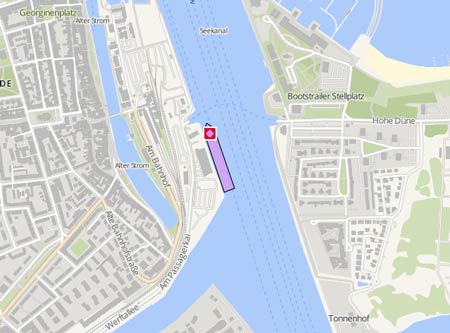
Police units from Lower Saxony and Schleswig-Holstein stormed the ' Scanlark' in the southern lock of the Kiel Canal in Kiel-Holtenau as a cross-state police operation. The "Scanlark," which was en route from Rotterdam to Fiejo. The ship was stormed by masked police officers immediately after docking in the south chamber at around 3 p.m. The visitor platform at the Holtenau Lock in Kiel closed. The reason for the operation was to avert danger, according to the State Police Office in Kiel. No further details were given. Meanwhile, at the lock, it is suspected that suspicion of sabotage could also be the reason for the action. The visitor platform and access to the lock were closed from 3 p.m. The webcam at the lock was also dimmed on police orders. The measures continued into the evening. Divers were also on site for the search throughout the night. The freighter's berth has been cordoned off. The ship was towed out of the lock ontot the Kiel Fjord by the tug 'Parat' (IMO: 8128212), turned around and pulled back into the Kiel Canal, where it was berthed at the Voith Quay of the North Port of Kiel at 6 p.m. After the ship had exitied the lock, the south chamber of the lock was reopened to shipping. During the transit from the lock to the Voithkai, the crew members were guarded by special forces from the Lower Saxony police. A rubber dinghy from the Lower Saxony police escorted the freighter along the canal. During the nighttime operation on the freighter, the crew was not allowed to leave the ship. Access to the quay was also sealed off. Divers entered the water and searched the ship's hull. Numerous vehicles were positioned alongside the ship on land. The police cited security measures as the reason for the operation. Further official information was not yet available. The 'Scanlark' remained stationary as of Sep 10. The "Scanlark" operates for the shipping company Vista Shipping Agency in Tallinn, Estonia. According to unconfirmed information, the crew members were all from Russia. The ship has been registered in the Caribbean state of St. Vincent and the Grenadines since 2006 and is a regular visitor to the Kiel Canal. On Dec 15, 200 the ship ran ashore on the island of Samsø at night en route from Aabenraa to Aarhus. According to an investigation by the Danish police, the Russian bridge crew may have fallen asleep at the time. In the past, the ship had been noticed for defects in various ports from time to time. Reports with photos: https://www.kn-online.de/mediabox/kiel/kiel-schleusenkammer-wegen-razzia-gesperrt-S2SSERITDNANPLQIT5KFJ4YTPU.html https://www.kn-online.de/schleswig-holstein/razzia-in-schleuse-in-kiel-was-ist-ueber-frachter-scanlark-bekannt-NLQ5ZXQAFVE7ZNMV3FTH32437M.html https://www.mopo.de/im-norden/schleswig-holstein/razzia-auf-frachtschiff-im-norden-maskierte-polizeikraefte-an-bord/
News schreiben