
ALFA 1

Kurs/Position
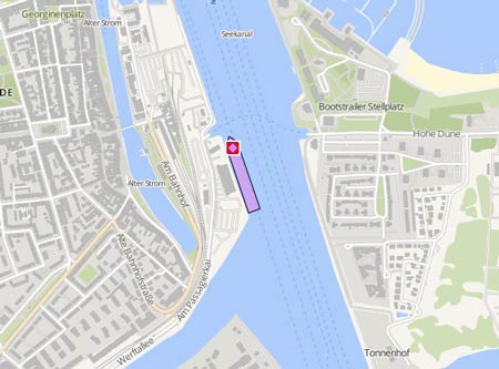
Die letzten Häfen
Die letzten Wegpunkte
Die neuesten Nachrichten
A number of vessels which export coal from occupied Ukrainian territory identified
The 'Alfa 1' is among those vessels, the Ukrainian Foreign Intelligence Service has idientfied to be involved in Russia's export of coking coal from temporarily occupied territories through the port of Mariupol, as part of a deliberate strategy to exploit the occupied territories, violating international law and the rules of warfare. The 'Alfa M' exported about 40.000 tons, the 'Alfa 1' more than 20,000 tons of coking coal, the 'Alpha Hermes' more than 5,000 tons, the "Victoria K' more than 20,000 tons, and the 'Victoria V' more than 35,000 tons, totalling to 120,000 tons of coal. The value of this coal will be sufficient to produce thousands of tons of steel. Russia is using the occupied Ukrainian territories as a source of raw materials to secure its economy. which is a serious violation of international humanitarian law, including the 1907 Hague Convention, which prohibits the use of resources of occupied territories for the benefit of the occupier without the consent of the legitimate authority.
Freighter grounded again
The "Mehmet Bay" with 17 crew members on board ran aground again on Aug 7, this time in the Fethiye district of Muğla. The ship, loaded with wheat was troubled in Samos on Aug 2, and while fixing its mechanical problem, ran aground. On Aug 7 she called Fethiye Bay to change some crew and replenish provisions, but ran aground five meters from the shore in the evening while approaching the anchorage, when the ship was maneuvering to avoid the collision with a fishing vessel. Coast Guard and Coast Guard General Directorate teams were sent to the site for safety reasons. The master did not request external assistance. The "Mehmet Bey" berthed in Iskenderun on Aug 19 at 7.30 p.m. and sailed again on Aug 23 at 6 a.m., bound to Sulina, ETA Aug 29. Turkish reports with photos and video: https://www.denizhaber.com/kazalar/malta-bayrakli-mehmet-bey-adli-gemi-fethiyede-karaya-h79690.html https://www.yenicaggazetesi.com.tr/muglada-kuru-yuk-gemisi-karaya-oturdu-244825h.htm https://www.yenisafak.com/en/video-gallery/news/cargo-ship-runs-aground-off-western-turkey-2202079 https://www.ogunhaber.com/asayis/bugday-yuklu-gemi-fethiyede-karaya-oturdu-1166554h.html
Mechanical trouble off Samos
The "Mehmet Bay" suffered mechanical problems and was moored off southern Samos on Aug 2, 2019. In the morning of Aug 3 she started moving, in restricted maneuverability status in pos. 37° 41.66' N 026° 39.65' E. The ship was en route from Amaliapolis to Iskenderun. It moored in pos. N 37° 41.50' N 026° 39.54' E near Psili Ammos on Aug 4 at 5.20 p.m. with the offshore tug "Pantokrator" (IMO: 9376880) which had sailed from Piraeus on Aug 3 at 5.20 p.m. on standby.
News schreiben